
Salt Marsh - Marshes Under Threat
Salt marshes are intertidal habitats, and salt marsh grasses will not survive if they are fully covered with salt water all the time. As sea level rises, salt marshes will either disappear as they are inundated, or migrate farther inland. Marsh migration depends on the availability of flat, low-lying terrain free of human development inland of existing marsh. Learn more about the response of marsh land to sea level rise here.
In this extension activity, you will use a mapping tool generated by NOAA (the National Oceanographic and Atmospheric Administration) to see how sea level rise may affect our coastline, and particularly our marshes. Write your answers to the six questions below on a piece of paper.
Step 1: Open the Sea Level Rise Viewer and select ‘get started’!
Step 2: Zoom in to Connecticut, and continue zooming until you find Bluff Point State Park. Bluff Point is located at the mouth of the Poquonnock River, a small river in Groton just east of the Thames River.
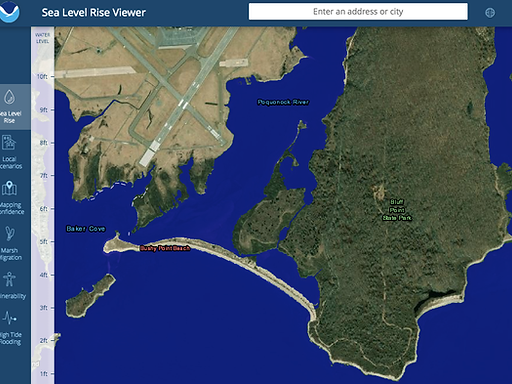
Step 3: In Connecticut, the sea level is projected to rise between two and seven feet by the year 2100 (Read this paper for more details). Use the Sea Level Rise viewer to explore how Bluff Point might change as a result of sea level rise.
Question 1: How would Bluff Point change as a result of a 2 foot sea level rise?
Question 2: How would Bluff Point change as a result of a 6 foot sea level rise?
Step 4: Next, find the Marsh Migration tool on the left hand toolbar. View the Marsh Migration tutorial to learn how to use the tool. You will need to zoom out to select the scenario icon located in the Thames River, then zoom back in to Bluff Point, which will now appear very pixilated. The Marsh is represented in purple (the legend is in the upper right - click the icon to see what all the colors mean).

Step 5: Use the sea level rise slider to explore how sea level rise will affect the marsh. Marshland can adapt to sea level rise if it is possible for the marsh to migrate to higher ground as the sea level rises.
Question 3: Based on what you see on the map as you toggle the sea level rise slider up and down, do you see evidence that the Bluff Point marsh could migrate as sea level rises? Explain your answer.
Step 6: Move west along the Connecticut coast to the mouth of the Connecticut River at Old Lyme, and find Great Island, a large marsh area.
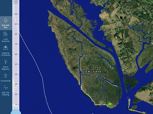
Question 4: How will Great Island change as a result of a 2 foot sea level rise?
Question 5: How will Great Island change as a result of a 6 foot sea level rise?
Question 6: Do you see evidence that the Great Island marsh could migrate as sea level rises? Explain your answer.